About US States Map
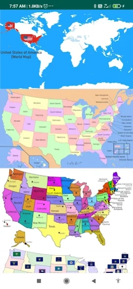
The United States of America is located on the North American Continent. The United States is bordered by the Pacific Ocean on its west coast, the Atlantic Ocean on its east coast, Canada to the north, and Mexico to the...
The United States of America is located on the North American Continent. The United States is bordered by the Pacific Ocean on its west coast, the Atlantic Ocean on its east coast, Canada to the north, and Mexico to the south.
The United States is a big country, and it definitely takes more effort to learn the US geography, US capitals, US states & American flags compared to other countries. Whether you're a high school student or just a curious learner, our US geography quiz 50 States will help you master US capitals, states, flags & US maps.
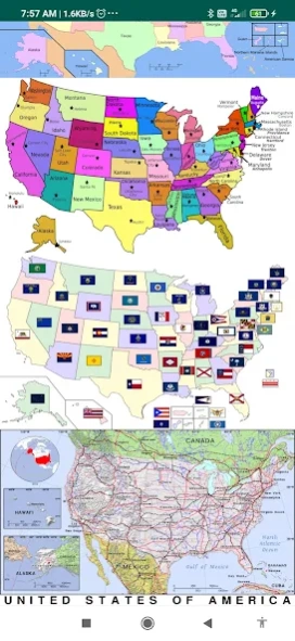
US States map contains information about all 50 US states, capitals, the state flag, and wiki links to know more about the state.
Capital Cities:- Via this Atlas app for Map Of USA you can get search for the Capital Cities of each state.
Must have mobile app features include:
50 us states map with capitals names
map of USA with states
u.s. states and capitals
united states map with cities
map of the USA with states and major cities' names
us atlas
American atlas
atlas of the united states
blank us map
political map of USA
us regions map
USA in world map
us river map
United states elevation map
topographic map of us
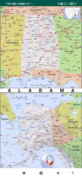
united states road map
This physical map of the US shows the terrain of all 50 states of the USA
List of States:
the map of Alaska, Washington dc on us map, Chicago map USA, Washington map USA, map of united states of America and Canada,
Alabama, Arizona, Arkansas, California, Colorado, Connecticut, Delaware, Florida, Georgia, Hawaii, Idaho, Illinois, Indiana, Iowa, Kansas, Kentucky, Louisiana, Maine, Maryland, Massachusetts, Michigan, Minnesota, Mississippi, Missouri, Montana, Nebraska, Nevada, New Hampshire, New Jersey, New Mexico, New York, North Carolina, North Dakota, Ohio, Oklahoma, Oregon, Pennsylvania, Rhode Island, South Carolina, South Dakota, Tennessee, Texas, Utah, Vermont, Virginia, Washington, West Virginia, Wisconsin, Wyoming.
United States Bordering Countries:
Canada, Mexico
Regional Maps:
Great Lakes, U.S. Territories, North America, World
Previous Versions
Here you can find the changelog of US States Map since it was posted on our website on 2023-06-27 13:33:36.
The latest version is 1.4 and it was updated on 2024-04-19 17:57:08. See below the changes in each version.
US States Map version 1.4
Updated At: 2023-12-04
Disclaimer
Official Google Play Link
We do not host US States Map on our servers. We did not scan it for viruses, adware, spyware or other type of malware. This app is hosted by Google and passed their terms and conditions to be listed there. We recommend caution when installing it.
The Google Play link for US States Map is provided to you by apps112.com without any warranties, representations or guarantees of any kind, so access it at your own risk.
If you have questions regarding this particular app contact the publisher directly. For questions about the functionalities of apps112.com contact us.